

Find Honaunau Bay and Two Step on the Map
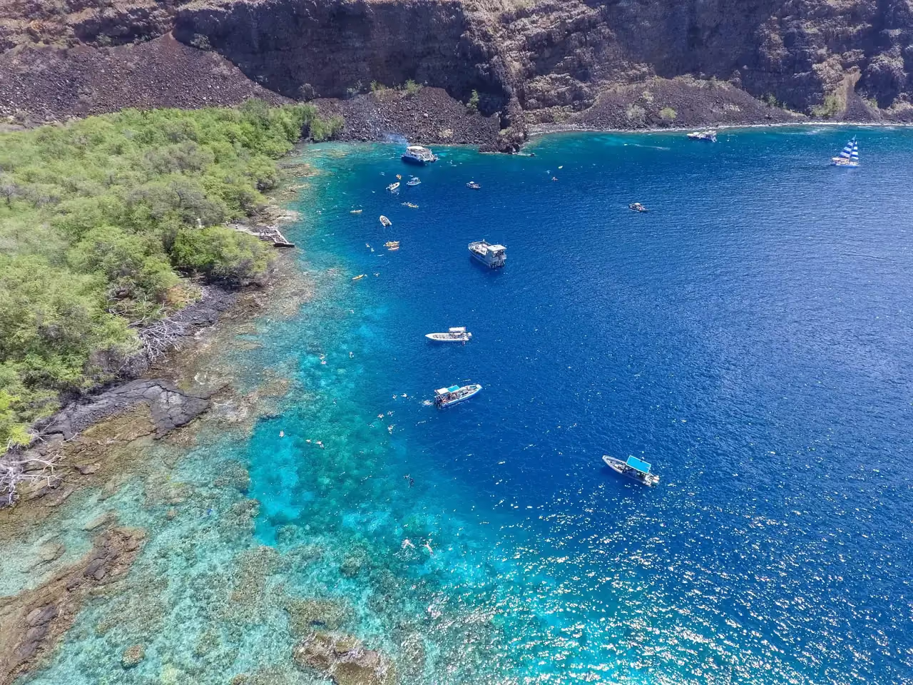
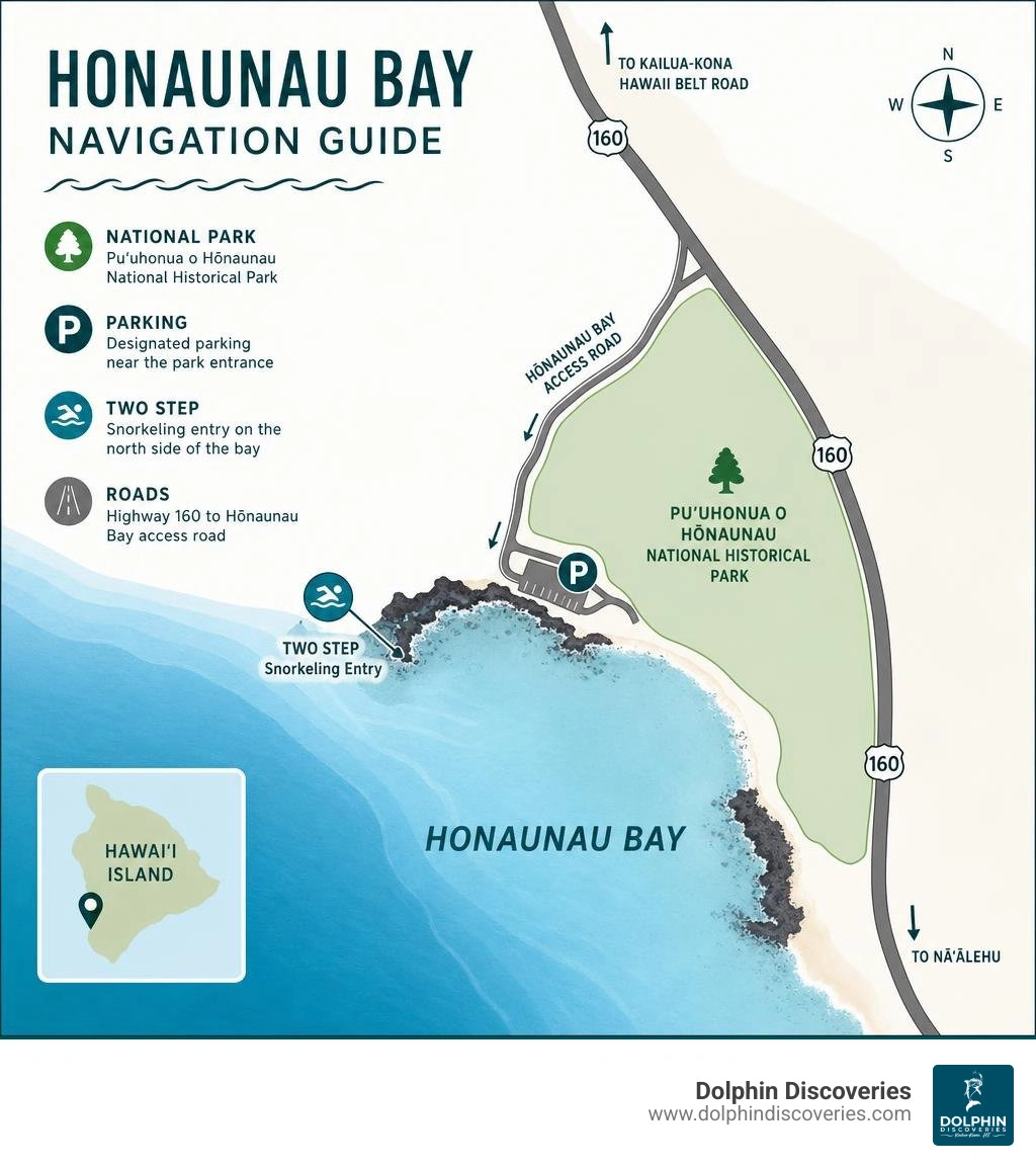
A Honaunau Bay map leads you to South Kona on Hawaii Island, beside Puʻuhonua o Hōnaunau National Historical Park and the lava-rock snorkeling entry known as Two Step, or Paeʻa.
| Quick map detail | What to look for |
|---|---|
| Location | South Kona coast, Hawaii Island |
| Main road from Kailua-Kona | Hawaii Belt Road, then Highway 160 toward the ocean |
| Key landmark | Puʻuhonua o Hōnaunau National Historical Park |
| Snorkel access | Two Step, on the bay's north side near the park |
| Best map tools | Google Maps for driving, NPS maps for park access, and USGS or NOAA charts for terrain and water detail |
This small stretch of coast can be confusing on a first visit. Parking, one-way local roads, the park entrance, and the rocky ocean entry are close together but serve different purposes. A good map helps you arrive prepared, respect the neighboring cultural site, and choose a safe plan for the day.
At Dolphin Discoveries, we are a Kona small-group marine tour company, and I am Shelley Carey, here to help you understand the shoreline before you step onto the lava ledge or into the water.
Key terms for honaunau bay map:
Understanding the Honaunau Bay Map: Geographic Location & Driving Directions
Honaunau Bay sits along the sheltered South Kona coast on the western side of Hawaii Island. Located roughly 20 miles south of Kailua-Kona, reaching this coastline takes about 35 to 40 minutes under normal traffic conditions. When you open a digital map or general directory to navigate here, tracking the transition from high-elevation highways down to the shoreline is simple.
To get here from Kailua-Kona, head south on Highway 11 (the Hawaii Belt Road). You will pass through scenic upslope communities in South Kona. Shortly after passing the Honaunau Post Office on your left, look for the junction with Highway 160 (Honaunau Road). Turn right onto Highway 160 and follow it down the slope for approximately 3.5 miles as it winds toward the ocean.
As you approach the coast, the road forks. Continuing straight leads directly to the entrance gate of Puʻuhonua o Hōnaunau National Historical Park. Turning right onto the small narrow access road takes you along the northern curve of the bay toward the popular ocean entry point.
Parking options at the bay require planning:
- Paid Lot: A private gravel parking lot sits right across from the main lava entry area for a modest daily fee of around $5.
- Park Parking: National park visitors can use the official visitor center parking lot inside Puʻuhonua o Hōnaunau National Historical Park (park entry fee applies).
- Street Parking: Limited free parallel parking exists along the narrow local road, but spots fill up quickly by early morning. Always respect local resident driveways and posted no-parking signs.
For a full geographical breakdown of the area, explore our guide About Honaunau Bay.
Key Features and Landmarks on the Honaunau Bay Map
When studying a detailed map of the bay, several prominent geographic landmarks immediately stand out:
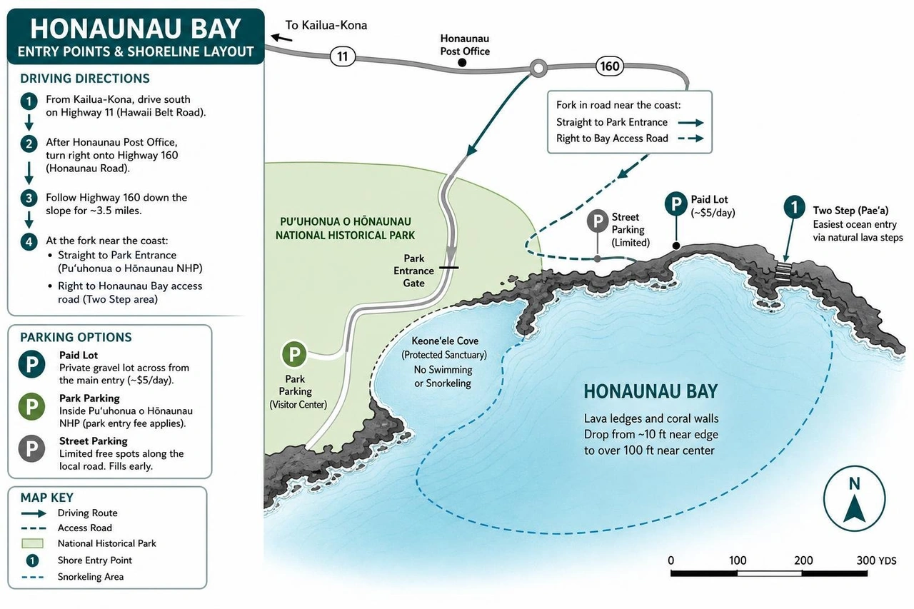
- Two Step (Paeʻa): Located on the northern side of the bay, this natural pahoehoe lava shelf features two distinct steps carved by ocean water, offering the easiest water entry.
- Keoneʻele Cove: A shallow, protected inlet inside the national historical park. Historically used as a royal canoe landing site, swimming and snorkeling are prohibited here today to preserve its sanctuary status and protect resting sea turtles.
- Lava Ledges and Coral Walls: The shoreline consists of steep volcanic shelves that drop into clear marine waters, quickly deepening from 10 feet near the edge to over 100 feet near the center of the bay.
Navigating Cartographic Types: Topographic, Nautical, and Park Maps
Depending on whether you are driving, hiking historical trails, or boating, different map formats offer specific geographic insights into South Kona:
- Topographic Maps: The USGS produces detailed topographic quadrangles. For instance, the 2024 Map of Honaunau is published at a 1:24,000 scale (24 x 29 inches), capturing local contour lines, ancient footpaths, elevation changes, and coastal drainage basins.
- Nautical Charts: Boaters and mariners rely on charts like the Kealakekua Bay to Honaunau Bay Nautical Chart (NOAA Chart 19332, scale 1:10,000). While NOAA officially cancelled raster versions of this chart in May 2022 to shift toward electronic navigation, historical charts detail depth soundings, reef hazards, and underwater drops.
- Benthic Habitat Maps: Scientific studies conducted by the USGS and National Park Service map the seafloor from the high tide line out to depths of 130 feet (40 meters), tracking coral cover, sand flats, and hard basalt substrate.
Ocean Entry, Snorkeling & Main Attractions
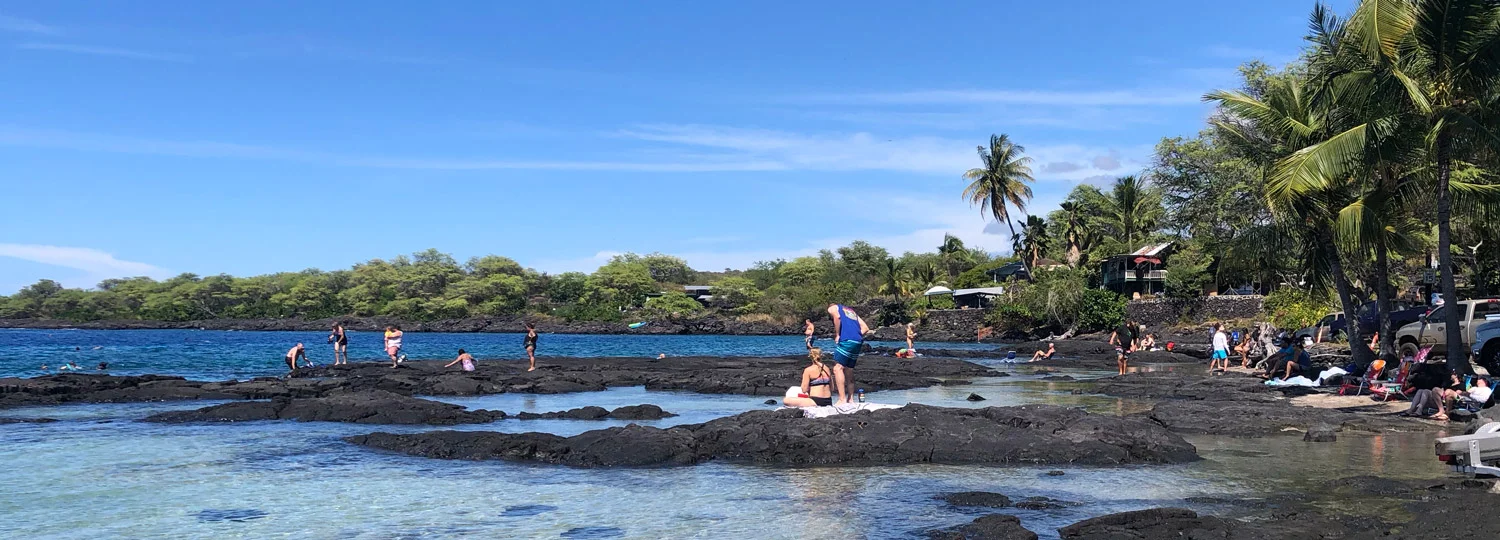
The marine environment at Honaunau Bay is world-renowned for its crystalline visibility and rich marine life. Because the bay is protected from large northern swells by surrounding headlands, water clarity frequently exceeds 80 feet, making it an exceptional destination for snorkeling and scuba diving.
To maximize your time on the water, review our detailed guides on Honaunau Bay Two Step, Honaunau Bay Snorkeling, and our comprehensive Best Snorkel Spots Big Island Guide.
Identifying Entry Points on a Honaunau Bay Map
On a specialized honaunau bay map, the main entry zone is marked at the flat pahoehoe lava shelf called Two Step. Entering the ocean here requires basic timing and awareness of ocean surge:
- Pahoehoe Ledge Entry: Walk carefully across the smooth basalt lava rock to the natural carved step.
- Timing the Surge: Watch the rise and fall of the swell. Sit on the lower step, slip on your fins, and push cleanly into the water as a wave swells up to meet you.
- Exiting Safely: When returning, swim up to the lower step, sit down onto the ledge, and let the gentle lift of the surge help float you upright onto your feet.
Underwater Features Mapped: Coral Reefs and Marine Life
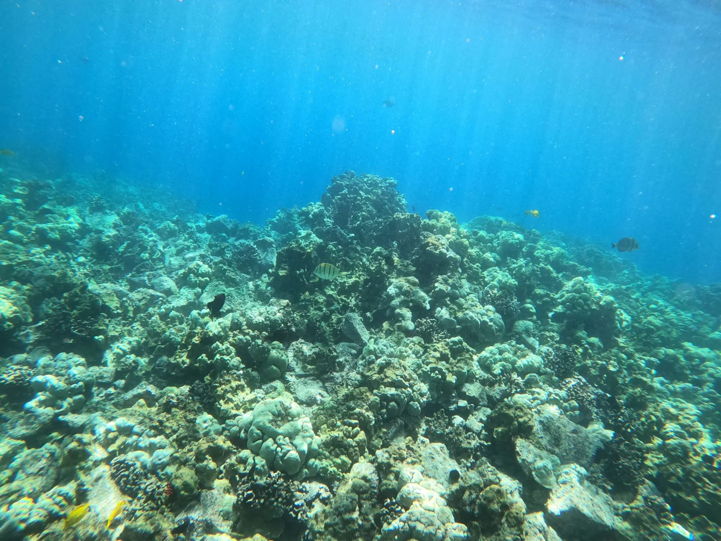
The benthic habitat at Honaunau Bay hosts thriving coral structures, including finger coral, lobe coral, and mound corals. These complex reefs supply vital habitat for native fish species such as yellow tang, parrotfish, butterflyfish, and humuhumunukunukuāpuaʻa.
Research from the Geologic Resource Evaluation Benthic Habitat Mapping shows that the bay's benthic shelf extends smoothly before dipping down toward sandy channels. Hawaiian green sea turtles (honu) frequent the shallow coral gardens to feed on algae, while pods of Hawaiian spinner dolphins often rest in the bay's calm, sandy-bottomed basins during daytime hours.
To learn more about exploring these marine environments safely across the region, check out our Kona Snorkeling Ultimate Guide 2026.
Historical Significance: Puʻuhonua o Hōnaunau National Historical Park
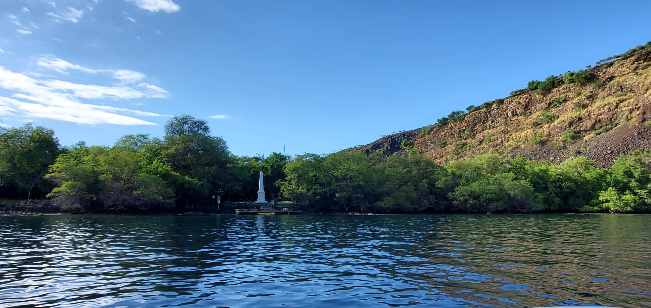
Directly adjacent to the snorkeling access point lies Puʻuhonua o Hōnaunau National Historical Park, an expansive 182-acre park that preserves one of Hawaii's most sacred cultural sites.
In ancient Hawaii, life was regulated by the kapu system, a strict code of religious laws. Breaking a kapu was punishable by death. However, if a lawbreaker could evade pursuers and reach a puʻuhonua (place of refuge), a kahuna (priest) would perform a purification ceremony, absolving the transgressor and granting safe return to society. Defeated warriors also found safe haven here during times of war.
Key historical features documented on the official Puʻuhonua o Hōnaunau Park Map and early historical maps like the 1982 Map of Honaunau include:
- Great Wall: A massive masonry wall constructed around 1550 AD without mortar, standing over 10 feet high and 17 feet thick, dividing the sacred royal grounds from the place of refuge.
- Hale o Keawe Heiau: A sacred temple housing the bones of high-ranking chiefs (aliʻi), guarded by carved wooden kiʻi statues that convey spiritual power (mana).
- Royal Grounds: The coastal area reserved exclusively for Hawaiian royalty, featuring Keoneʻele Cove and traditional thatched structures.
- Kiʻilae Village: Located along the park's southern coastal trail, preserving remnants of an ancient agricultural settlement.
Visitors should show deep cultural respect when visiting this landscape. Bathing suits and wet clothes are strictly prohibited within the national historical park grounds; proper clothing coverups or street dress must be worn when entering the park boundaries.
Visitor Guidelines: Rules, Amenities, Safety & Nearby Attractions
To ensure a safe and respectful visit to Honaunau Bay, keep in mind that amenities at the beach area are limited. Planning ahead makes a huge difference in your experience.
| Considerations | Morning Conditions | Afternoon Conditions |
|---|---|---|
| Water Conditions | Calm, mirror-like surface; ideal visibility | Rising winds, chop, reduced marine visibility |
| Crowd Density | Lower crowding before 9:00 AM | Busy parking and crowded lava ledges |
| Sun Exposure | Moderate solar heat | High solar intensity; shade is very limited |
| Amenities Available | Porta-potties; no freshwater showers | Porta-potties; no freshwater showers |
Important visitor rules and wildlife protection guidelines include:
- Reef-Safe Sunscreen: Hawaii law bans sunscreens containing oxybenzone and octinoxate. Use mineral-based sunscreens (zinc oxide or titanium dioxide) or wear UV rash guards to prevent damage to delicate coral reefs.
- Spinner Dolphin Rule: Under federal MMPA regulations established by NOAA, it is illegal to swim within 50 yards of Hawaiian spinner dolphins in wild coastal waters. Dolphins use shallow bays to sleep and recharge during the day; give them ample space.
- Sea Turtle Distance: Maintain a respectful distance of at least 10 feet (3 meters) from Hawaiian green sea turtles at all times, whether they are swimming or basking along the shore.
- Freshwater Workaround: Because there are no public showers or drinking water spigots at Two Step, bring a large jug of fresh water in your rental car to rinse gear and salt water off after swimming.
If you are exploring more of South Kona, combine your trip to Honaunau Bay with a visit to nearby Kealakekua Bay State Historical Park, located just 15 minutes to the north. Learn more in our detailed guide, A Guide to Kealakekua Bay.
Frequently Asked Questions About Honaunau Bay
How do I locate Two Step on a Honaunau Bay map?
Two Step is located on the north side of Honaunau Bay along the narrow public access road just past the private paid parking lot, right before the boundary fence of Puʻuhonua o Hōnaunau National Historical Park.
Where can I find official park maps for Puʻuhonua o Hōnaunau?
You can access digital maps on the official U.S. National Park Service website or pick up a free physical park brochure map at the park's visitor center upon arrival.
What are the parking options shown on the Honaunau Bay map?
Parking options include a paid private lot directly across from Two Step, limited street parking along the access road, and official park parking inside the national historical park for park visitors.
Conclusion & South Kona Ocean Adventures
Using a detailed honaunau bay map makes navigating South Kona's roads, cultural sites, and entry points straightforward. Understanding where to park, how to enter the water safely, and how to respect sacred historical grounds ensures a great visit to this magnificent coastline.
If you prefer exploring the Big Island's rich marine life without worrying about driving or street parking, join us at Dolphin Discoveries. Operating out of nearby Keauhou Bay, our small-group, naturalist-led boat excursions offer relaxed access to Kona's top reef locations. Explore our options for Kona Snorkeling Tours to discover South Kona's underwater wonders with our experienced local crew.